- Rajasthan
- Kerala
- Maharastra
- Tamilnadu


 City : Kannur
Location : South India
Language : Malayalam, Tamil, English
Know About Kannur
Kannur, is a city and a municipality in Kannur district in the Indian state of Kerala. It is the administrative headquarters of Kannur district.
Kannur is the fourth largest urban agglomeration in Kerala after Kochi, Thiruvananthapuram and Kozhikode with a population of 498,175. According to data compiled by economics research firm Indicus Analytics on residences, earnings and investments, Kannur is one of the best ten cities in India to reside. Indicus considered six parameters — health, education, environment, safety, public facilities and entertainment — for preparing the 'reside-in' index. It is popularly known as the city of Looms and Lores. Theyyam is the famous performing art of Kannur. Kannur is also famous for its beautiful virgin beaches. Another attraction of Kannur is the Handlooms.
Kannur is the fourth largest urban agglomeration in Kerala after Kochi, Thiruvananthapuram and Kozhikode with a population of 498,175. According to data compiled by economics research firm Indicus Analytics on residences, earnings and investments, Kannur is one of the best ten cities in India to reside. Indicus considered six parameters — health, education, environment, safety, public facilities and entertainment — for preparing the 'reside-in' index. It is popularly known as the city of Looms and Lores. Theyyam is the famous performing art of Kannur. Kannur is also famous for its beautiful virgin beaches. Another attraction of Kannur is the Handlooms.
History
Kannur was an important port on the Arabian Sea which carried out trade with Persia and Arabia in the twelfth and thirteenth centuries and it was the British military headquarters on India's west coast up to 1887. In conjunction with her elder sister Tellicherry it was the third largest city on the western coast of British India in the eighteenth century, after Bombay and Karachi.
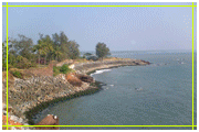
St. Angelo's Fort was built in 1505 by Sir Francisco de Almeida, the first Portuguese Viceroy of India and is on the Arabian sea about 3 km from Kannur town. The fort changed hands several times. In 1663 the Dutch captured it and sold it to the Arakkal royal family. The British conquered it in 1790 and transformed it into one of their major military stations on the Malabar Coast. It is fairly well preserved as a protected monument under the Archaeological Survey of India. A painting of this fort and the fishing ferry behind it can be seen in the Rijksmuseum in Amsterdam. The body of Kunjali Marakkar was exhibited in this Fort after his assassination.
During the British rule in India, Kannur was known by the English name Cannanore. However, the usage of the name Cannanore is still not uncommon.
During the British rule in India, Kannur was known by the English name Cannanore. However, the usage of the name Cannanore is still not uncommon.
Geography
Kottayam is located at 9.58° N 76.52° E. It has an average elevation of 3 metres (9 feet).
Seematti Junction, KottayamKottayam town is flanked by the Meenachil river and Kodoor river and Vembanad lake. Kottayam is considered to be part of the Midlands of Kerala, and the climate is also pretty moderate. Kottayam is located in the south-central half of Kerala state. Ernakulam lies to the North, Alappuzha lies to the West, Idukki lies in the East, and Pathanamthitta lies to the South of Kottayam. Kottayam was the part of Travancore kingdom, before the formation of Kerala state.
Seematti Junction, KottayamKottayam town is flanked by the Meenachil river and Kodoor river and Vembanad lake. Kottayam is considered to be part of the Midlands of Kerala, and the climate is also pretty moderate. Kottayam is located in the south-central half of Kerala state. Ernakulam lies to the North, Alappuzha lies to the West, Idukki lies in the East, and Pathanamthitta lies to the South of Kottayam. Kottayam was the part of Travancore kingdom, before the formation of Kerala state.
Transport
Railway Station
Kannur is easily reachable by road, rail, air and sea.
Kannur is on the National Highway 17 (NH-17) between Mahe and Talapady. The roads in the city are well laid out, although the condition of the roads is affected during the monsoon season.
The two airports at Mangalore, Karnataka in the north and Kozhikode in the south are just about 125 killometers away from Kannur.Kannur international airport is coming up at mattanur,once operational Kannur international airport will be the largest airport in Kerala.
Kannur is an ancient sea port. The nearest all-weather sea port is Mangalore, presently in Karnataka state. The inland water transport system connecting Perumba and Thaliparamba was constructed in 1766 by the Ali Raja of Kannur. This 3.8 km long canal is known as the Sultan's Canal. The west flowing rivers are used for navigation. The Valappattanam river, 55 km and Anjarakandi river, 23 km. The nearest airport is Kozhikode.